Using the DNR - Alaska Land Records
Alaska Land Records
http://plats.landrecords.info/
This site is used for searching for information which appears on the state land status plats. It does not cover federal mining claims unless they are patented or have had a mineral survey. The federal plats are available, however.
Let's assume that we are looking for information on claims on upper Deadwood creek. Begin by clicking on the link above or on the link on the bottomdollar.us home page. This will bring up the following screen.
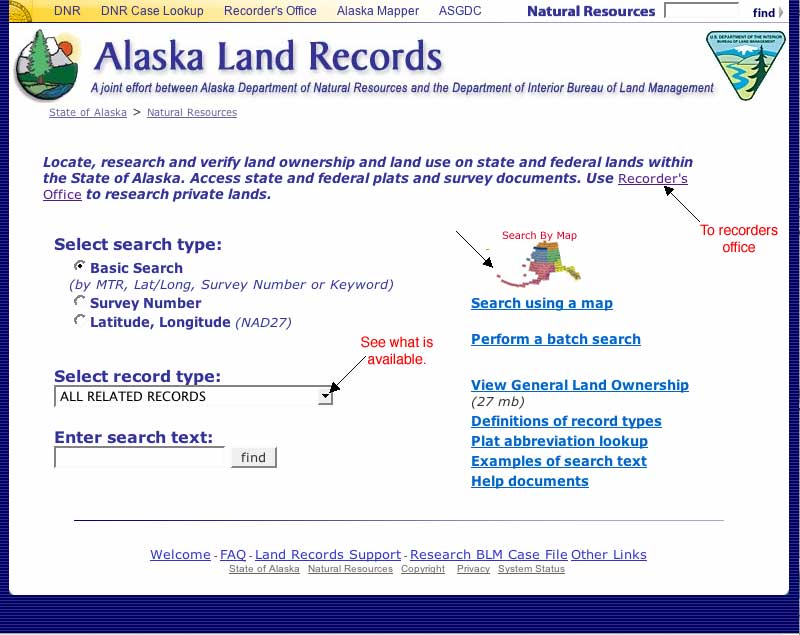
From this screen you may go to the recorder's office, click on the small triangle to see what kind of records are available, search by entering text, or use the map search. I recommend using the maps search unless you already have information on what you are looking for. Clicking on the map link or on the image of the map brings up the next screen.
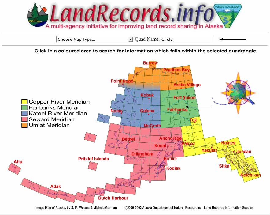
As you move the little hand cursor across the map, the Quadrangle you are currently on is shown in the Quad Name field. The Quadrangle name will also appear under the hand cursor if you wait a few seconds.. Clicking on the quadrangle will now bring up the large quadrangle map. This map has scrolled to the area we are interested in using the scroll bars at the right and bottom
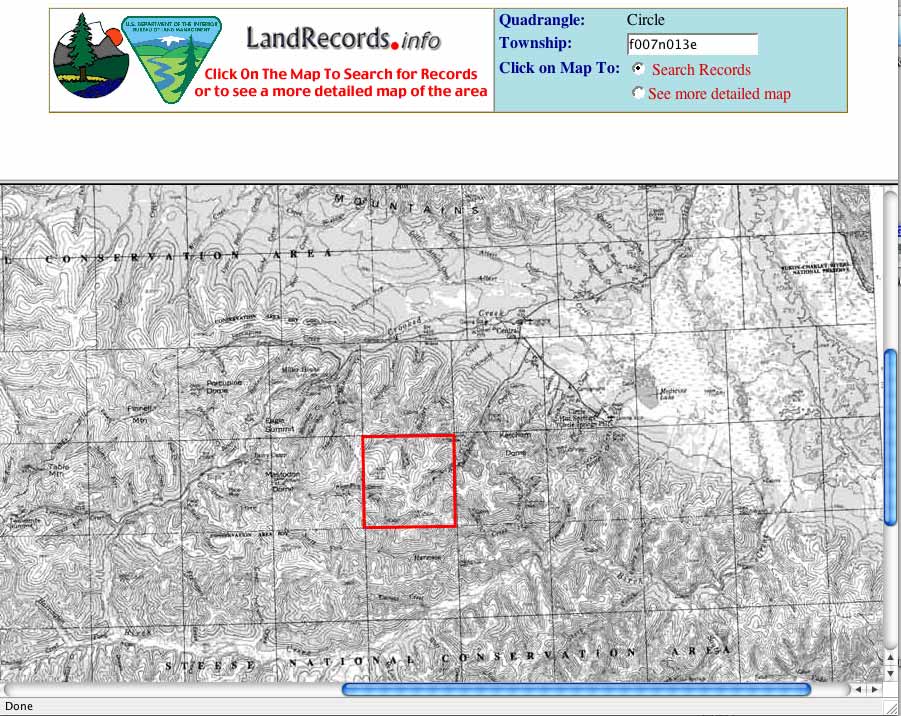
Move the arrow cursor over the map. The name of the township changes as you move the cursor. I have highlighted the township we want in red. Position the mouse over the township, click, and the information available for that township will be displayed.
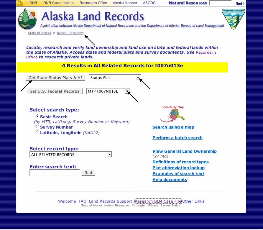
The search results in four records.
Two are from the state: Status Plat and State Historical Index.
Two are from BLM: MTP F007N013E (Master Title Plat) and USRS F007N013E 1 (US Rectangular Survey)
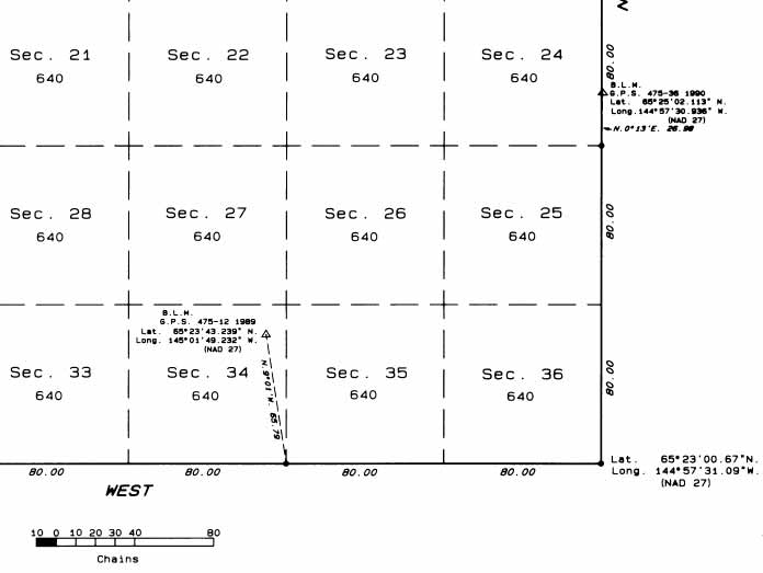
MTP F007N013E shows a verified altitude bench mark and that the land has been tentatively approved for transfer to the state.
USRS F007N013E 1 is similar but includes several GPS measurements. a section of USRS F007N013E 1 is shown below
But we want the status plat so click on "Get State Status Plat...". This downloads the follwing PDF file which on the Macintosh will usually show up in Preview or Adobe Reader
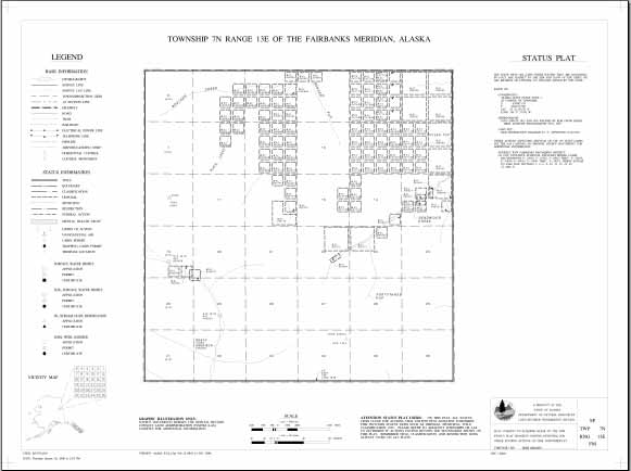
This file will appear larger than this and you should be able to zoom (see below) in on it and read it.
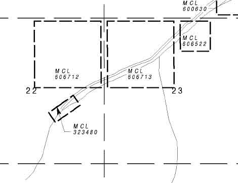
We see several mining claims (MCL). Consider MCL xxxxxx, this the same as ADL xxxxxx and from the Land Records page we click on natural resources. Then we click on Case File and Land Abstracts. We may also get here by selecting "Land Records - Case Files" directly from my home page. Either method leads us to:
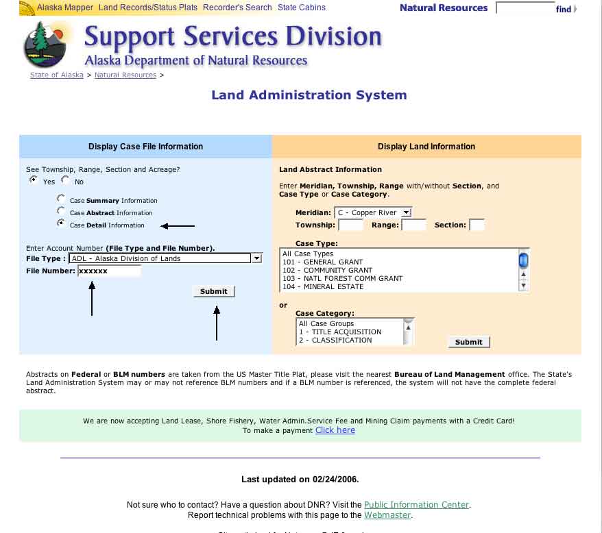
Fill in the ADL number and how much information you want and hit the submit button. This will bring up the casefile as a web page. You will find out who owns the claim, when it was filed, the assessment work filings, indications of when mining plans were submitted, etc.